- Home
- Everyday Life
- Satnav
Satnav
How your phone or satnav knows exactly where you are, and how it finds the way.
The short version
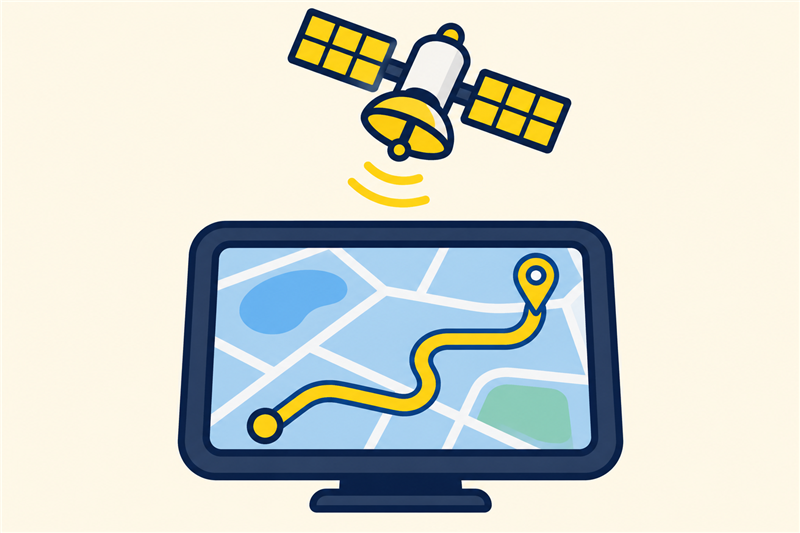
About thirty GPS satellites orbit high above the Earth, each sending out its position and the exact time. Your phone or satnav listens to several, works out how far away each is from the time the signals took to arrive, and calculates where it must be. Then software finds the best road route.
I always thought my phone talked to the satellites, and the satellites worked out where I was.
It is the other way round. Satellites do not know you exist.
Finding your position
Each GPS satellite carries a very accurate atomic clock. Every fraction of a second it broadcasts a message saying where it is and what time it is.
Your device listens. The signal travels at the speed of light, so it takes less than a tenth of a second to arrive from the 20,200 kilometres up. By comparing the time the message was sent with the time it arrived, the device works out the distance. Distance equals speed multiplied by time.
One distance puts you somewhere on a huge sphere around that satellite. Two spheres overlap in a circle. Three spheres meet at two points, and one of them is usually somewhere out in space. A fourth satellite settles it, and fixes your device's own clock as well.
Why four satellites
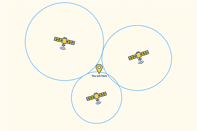
Each satellite gives a distance, drawn here as a circle around it. Where the circles cross is where you are. A real satnav does this in three dimensions, so it needs four satellites, not three, to work out its position and correct its own clock.
Your device only listens. It never sends a signal to the satellites, which is why millions can use it at the same time.
A satnav needs mobile signal to know where you are.
The position comes from satellites and works without mobile data. Phones need data for new maps and live traffic, but a satnav or phone with stored maps works anywhere with a clear view of the sky.
300 metres
How far out your position would be if your device's clock was wrong by one millionth of a second. Light travels 300 metres in that time, so the clocks have to be extraordinarily accurate.
Finding the way
Once the device knows where you are, the rest is map software. The roads are stored as a network of points and links, each with a length, a speed limit and sometimes a live traffic delay.
The software searches that network for the quickest chain of links from where you are to where you want to be. It tests many possible routes very fast and picks the one with the lowest total time. If you leave the route, it finds a new one from where you are.
How GPS came about
- 1973 The United States Department of Defense starts the GPS project.
- 1978 The first test satellite is launched.
- 1995 The system is declared fully working, with 24 satellites.
- 2000 The deliberate blurring of civilian signals is switched off, making satnavs much more accurate.
Why the clocks are adjusted for relativity
Einstein's theories of relativity say that time passes at slightly different rates depending on speed and gravity. For GPS satellites the two effects pull in opposite directions.
The satellites move fast, which slows their clocks by about 7 millionths of a second a day. They are also far from the Earth's gravity, which speeds them up by about 45 millionths of a second a day. The net result is that a satellite clock runs about 38 millionths of a second a day fast compared with a clock on the ground.
That sounds tiny, but at 300 metres per millionth of a second it would put your position out by about 11 kilometres after a single day. So the satellites' clocks are deliberately set to run slightly slow before launch, to cancel it out.
Sources: GPS.gov on the satellite constellation, how GPS signals provide time and position, and how receivers use satellite distances. Figures are approximate.
Key takeaways
- GPS satellites broadcast their position and the time.
- Your device works out distances from the signal's travel time.
- Four satellites are needed to fix position and clock.
- GPS works without mobile data; maps may need it.
- Route software searches a network of roads for the fastest path.
Now you know.
Satellites broadcast; your device does the work.
It finds your position by timing signals.
And it works without mobile data.
Last reviewed 3 Nov 2026
Where next?
More in Everyday Life
-
Read
 Everyday Life
Washing machine
How a washing machine fills, heats, tumbles, rinses and spins, and why detergent and gentle tumbling clean…
-
Read
 Everyday Life
Charging an electric car
How charging an electric car works: the difference between kW and kWh, how long a charge takes at home and on…
-
Read
 Everyday Life
Car brakes
How car brakes work: fluid carries your foot's push to each wheel, pads squeeze a disc, and why doubling…